Bridleway
From the Chilmark road, C.276, at the Millhouse, leading south-west across path No. 7 and then south-east to the Salisbury – Shaftesbury Trunk Road, A.30, opposite Scotland Buildings. Approximate length: 1005 metres. Width: 1 metre. Subject to ploughing.
North to South
The path leaves Tisbury Road [1] by a metal finger post (000290) indicating a Public Bridleway and goes between two houses and fenced paddocks on either side.
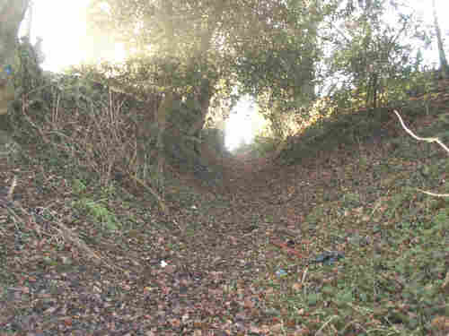
At the top of the field is a dismantled stile (999289) and once passing through this, turn left along the sunken path until a sharp right turn by a tree on which is a Footpath disc pointing along Path 7 and a Bridleway disc pointing along our path [3]. which climbs slightly before becoming narrower due to the encroachment of vegetation and small trees.
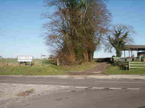
The path then broadens into an obvious green track [4] that leads down to the A30 where there is a finger post (002282), indicating the direction back towards the Tisbury Road at ¾ mile [5].


South to North
The path begins at the A30 [5] opposite to the turning to Broad Chalke, where there is a finger post (002282), indicating the direction to the Tisbury Road at ¾ mile. Go along the obvious green track [4] and into the part where it narrows, due to the encroachment of vegetation and small trees.
Soon you will come to a bend in the path [3] where you turn left to continue (or you can, if you wish, turn right to follow Path 7 ).
After about 60 metres, there is a dismantled stile [2] on your right (999289). Go through it and, keeping between the two wooden fences, head downhill for the exit of the field. This will bring you, between two houses [1] to Tisbury Road where the path ends, at a Public Bridleway sign (000290).
M.C.L.H.
June 2004