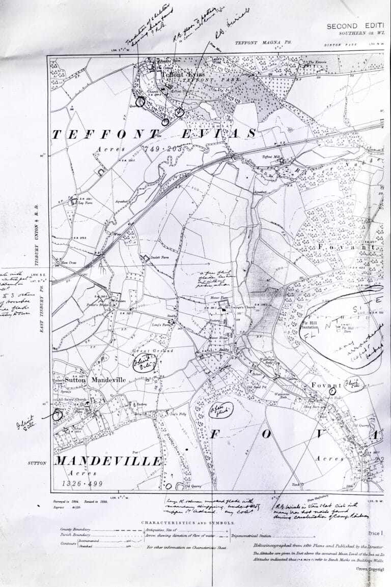
A number of maps have been collected into a book ‘Printed Maps of Wiltshire 1787–1844’ published by the Wiltshire Record Society in 1996 and edited by Dr John Chandler. Many of the maps in the book include Fovant and an extract has been made from each for this page.
The book also contains a great deal of information about the map-makers and some of that information accompanies the extracts.
F.H.I.G. would like to thank Dr Chandler and the Wiltshire Record Society for allowing the maps and the information to be included on this website.
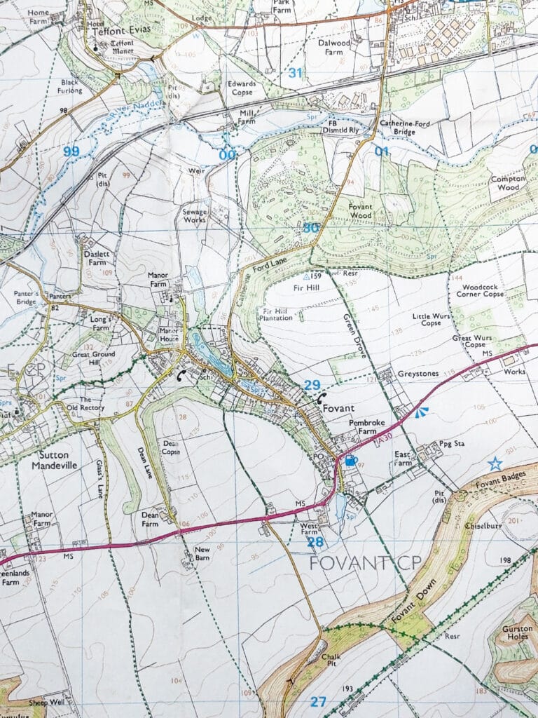
The notes with each extract, include where the complete maps may be examined, but first of all it would be worthwhile looking at the current OS map, as many of the features on the old maps are still recognisable and it is interesting to see how (or indeed if) Fovant has changed through the centuries.
Image produced from the Ordnance Survey Get-a-map service. Image reproduced with kind permission of Ordnance Survey and Ordnance Survey of Northern Ireland.
The maps are shown in chronological order and each of the ‘thumbnails’ can be enlarged by clicking on them
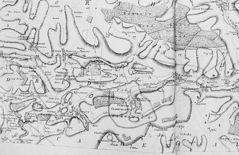
Andrews and Dury – Map of Wiltshire 1773.
Whilst road maps of the country had been produced in the sixteenth century, one of the first useful maps showing Fovant itself was that produced by John Andrews and Andrew Dury in 1773. This was in response to a prize offered by the Royal Society of Arts for county maps at a scale of one inch to one mile. In the context of roads , Dr Clay notes of this map:
Leatler Lane is shown as a highroad. Mansion Road is not shown. There are two houses at Folly Bridge. No woods are growing on the right hand side of the road from Fovant to Dinton until the top of Dinton Hill.
Although the map is of a fairly small scale, you can see that the shape of the village and its roads are very much as they are today. As Dr Clay says, the woods near to Fovant seem to be quite sparse, although towards Compton Chamberlayne they were extensive, as they still are.
Long before the use of contour lines, there was some attempt to show relief on the map by means of shading.
John Cary – Wiltshire 1787
 John Cary, who was born near Warminster, left Wiltshire to become an apprentice to a London engraver in 1770. Around 1783 he established himself as a surveyor and engraver and sold maps of all kinds. He died in 1835.
Whilst Fovant is shown as little more than a blob and the village roads are not as detailed as in the Andrews & Dury map, it is clear that the turnpike road passing Chiselbury was considered to be of equal, if not more, importance than the road nearer to the village. That road itself became a turnpike in the same year that the map was produced.
The original scale of the map shown was 1:362,000 and it was published in 1787. A copy is held in the Wiltshire Local Studies Library at Trowbridge.
William Tunnicliffe – A New Map of Wiltshire 1791
 William Tunnicliffe was a land surveyor who seems to have produced very few maps. The map shown, which was sold in Salisbury in 1791, does not compare favourably with the two shown previously on this website. It is sketchy in the extreme and shows little more than the parish boundaries.
It is interesting that Compton Chamberlayne is shown as Part of S. Damerham Hundred, separately from the Cawden & Cadworth Hundred of Fovant and other parishes around.
The original scale of the map shown was 1:195,000 and a copy is held in the Wiltshire & Swindon Record Office
Charles Smith – A New Map of the County of Wilts 1801
 Charles Smith was a publisher of maps, rather than a surveyor and the Wiltshire map was part of ” Smith’s New English Atlas ” finally published in 1804.
This is quite a clear map which attempts to show the location of groups of houses. On the roads it also shows the mileage from Salisbury. For the first time, Fovant Hut is shown on the old turnpike.
The large figure 22 in the centre of the map is shown on a separate key to be the Hundred of South Damerham.
The original scale of the map shown was 1:177,400 and a copy is held in the Wiltshire & Swindon Record Office.
John Cary – A New Map of Wiltshire 1801
 Some 14 years after his earlier work, John Cary produced “Cary’s New English Atlas” . The Wiltshire section of this atlas was published in 1801, some nine months after Smith’s map described above.
Whilst the road pattern of Fovant is now clearer, it is still not as detailed as the Andrews & Dury map of 28 years earlier. The new turnpike is now given equal prominence as that of the old one passing Chiselbury, allthough the dashed border to the old turnpike probably implies that the road high on the downs was unfenced.
Fovant Hut is marked and is still there, but note that between there and Chiselbury is marked Old Hall of which there is now no trace. This map also shows the physical relief of the landscape, which the intervening maps since Andrews & Dury have not attempted.
The scale of the map is 1:176,300 and a copy is held in the Wiltshire & Swindon Record Office.
Ordnance Survey – First Edition 1811
 The survey into our area started in 1794 and, after the maps were drawn and engraved, Sheet 15, named Salisbury, was first published in 1811. Later editions added more detail, including railways, but the example shown is the map in its earliest state.
Christopher Greenwood – Map of the County of Wilts 1820
 Christopher Greenwood was a Yorkshireman who, with partners, published an atlas of most of the English and Welsh counties. He then turned to producing smaller county maps. These were in the wake of the first Ordnance Survey maps and, although he may have used their information, he also relied on many other sources.
He advertised his maps in the Salisbury & Winchester Journal (even before the survey was complete) and the example shown was published in 1820.
This map shows much more detail than previous maps. There are considerably more houses, the Pembroke Arms is shown and the road pattern can easily be traced on the modern map. Shading has again been used to indicate the lie of the land.
The scale of the map is 1:63,360 (one inch to a mile) and a copy is held in the Wiltshire Local Studies Library at Trowbridge.
Philip Crocker – Maps of Hundreds for the History of Modern Wiltshire 1829
 Philip Crocker, of Frome, followed his father as a land surveyor and from 1805 to 1812 he was one of four civilian surveyors employed by the Ordnance Survey. He then became Sir Richard Colt Hoare’s land steward at Stourhead until his death in 1841. Colt Hoare wrote Ancient Wiltshire and Modern Wiltshire and it is almost certain that Philip Crocker produced the maps to accompany them. Incidently, John Cary engraved some at least of the maps.
A considerable amount of research has been carried out by the Wiltshire Archaeological & Natural History Society on the production of these maps, but it is not clear as to whether any of the maps have found their way into a public collection.
The maps themselves are of a very high standard. Houses are represented separately, the roads appear to be accurately placed and the landscape is depicted by the form of shading known as hachuring, which gives a clear impression of the physical features.
Other maps
Numerous other maps of Wiltshire were published and a selection of these can be found on a genealogy web site or a website specialising on old maps .


