How long the Fifield settlement remained as a single entity is not known, but since the later Iron Age was a period of considerable unrest the group would undoubtedly have been affected by events outside their boundaries. Smaller hill forts such as Chiselbury were replaced by vast and heavily defendable regional hill forts, and these became the nuclei for settlement, grain storage and trade. Castle Ditches near Tisbury, our nearest large hill fort of this type, may well have absorbed the Fifield inhabitants as peaceful life in the smaller unit became more uncertain.
The gradual evolution of larger units led to over twenty different tribes throughout Ancient Britain. It is doubtful that there were any hard and fast boundaries however as many of these tribes were a confederation of smaller groups. As far as Fovant is concerned our ancestors would appear to come within the orbit of the Durotriges who lived in modern Somerset, Dorset and South Wiltshire. The Durotriges presented an organised society, based in the farming of lands surrounded and controlled by strong hill forts. The strongest of these hill forts, and the largest one of its kind during this period was Maiden Castle in Dorset. The site plan (click to enlarge) is shown below:

‘Maiden’ derives from the Celtic Mai Dun’ meaning ‘great hill’
Dated artefacts from the site suggest that the construction of Maiden Castle began as far back as 3000 BC during the Neolithic period. It would seem that the site was largely deserted by 2000 BC but to have come into use again during the Iron Age. lt was during this period that the fort was massively extended. Three ditches were built, ramparts and ditches were enlarged, a wooden fence was built along the ramparts and wooden gates were installed at the entrances
The Roman invasion
Although at this time Britain was on the edge of the then known world, trading between the peoples of Britain and Europe, and indeed further afield, had long been established. Undoubtedly ideas and opinions would have been exchanged during these transactions, and almost certainly, assistance in mutually advantageous deals could have been offered and taken up by all sides. Some of these arrangements did not meet with the approval of Rome, the superpower of the time, so in 55 and 54 BC Julius Caesar sent short-lived expeditions to Britain. In either case the Romans were defeated or placated, and left our shores.
Almost a century after the Roman punitive expeditions, a well-planned invasion of Britain took place in the summer of AD43. Landing on the south coast of Britain the Romans pushed further west, eventually coming into contact with ‘our tribe’, the Durotriges, at Maiden Castle. Not surprisingly the tribe put up a fierce resistance, but it was outmatched by the 11th Augusta Legion, under the command of Vespasian, whose soldiers were finally victorious. After a few demonstrative skirmishes in the first decades of the Roman occupation, many existing tribal chiefs remained in place, but the Durotriges, like many other tribes throughout Britain at that time, eventually became Romanised and were securely included in the Roman province of Britannia.
 After the Roman occupation, Old Sarum became a crossing point for two major roads. One route headed north of the River Nadder and thence west towards the Bath area, and the other, after crossing the River Ebble to the south, led on to the coastal area of Hamworthy. According to the Ordnance Survey map of Roman Britain, several minor occupation sites existed in the large area sandwiched between these two roads. (Click to enlarge the map on the right).
The Closest to Fovant was the Wick ball camp half way between Teffont and Dinon.
Summary
Slight univallate hillfort called Wick Ball Camp.
Source: Historic England
Details
This record was the subject of a minor enhancement on 1 July 2015. This record has been generated from an “old county number” (OCN) scheduling record. These are monuments that were not reviewed under the Monuments Protection Programme and are some of our oldest designation records. As such they do not yet have the full descriptions of their modernised counterparts available. Please contact us if you would like further information.
This monument includes a slight univallate hillfort situated on the summit of a prominent hill called The Common overlooking both a dry valley and the more distant River Nadder. The hillfort survives as a roughly rectangular enclosure covering 3.9ha in total and defined by a single rampart bank standing up to 14m wide and 1.8m high, with a 13m wide and up to 2.1m deep outer ditch. The earthworks are best preserved to the north. The interior measures approximately 209m long by 150m wide. There are two entrances both to the north, one a simple gap and the second protected by a slight outwork. Chance finds of a flint scraper and some Iron Age pottery were made in 1898. A partial excavation by Clay in 1926 found no conclusive dating evidence.
The hillfort lies partly within the Grade II Registered Park and Garden of Dinton Park (Philipps House).
Source: Historic England
Reasons for Scheduling
Cranborne Chase is an area of chalkland well known for its high number, density and diversity of archaeological remains. These include a rare combination of Neolithic and Early Bronze Age sites, comprising one of the largest concentrations of burial monuments in England, the largest known cursus (a linear ritual monument) and a significant number and range of henge monuments (Late Neolithic ceremonial centres). Other important remains include a variety of enclosures, settlements, field systems and linear boundaries which date throughout prehistory and into the Romano-British and medieval periods. This high level of survival of archaeological remains is due largely to the later history of the Chase. Cranborne Chase formed a Royal Hunting Ground from at least Norman times, and much of the archaeological survival within the area resulted from associated laws controlling land-use which applied until 1830. The unique archaeological character of the Chase has attracted much attention over the years, notably during the later 19th century, by the pioneering work on the Chase of General Pitt-Rivers, Sir Richard Colt Hoare and Edward Cunnington, often regarded as the fathers of British archaeology. Archaeological investigations have continued throughout the 20th century and to the present day. Slight univallate hillforts are defined as enclosures of various shapes, generally between 1ha and 10ha in size, situated on or close to hilltops and defined by a single line of earthworks, the scale of which is relatively small. They date to between the Late Bronze Age and Early Iron Age (eighth to fifth centuries BC), the majority being used for 150 to 200 years prior to their abandonment or reconstruction. Slight univallate hillforts have generally been interpreted as stock enclosures, redistribution centres, places of refuge and permanent settlements. The earthworks generally include a rampart, narrow level berm, external ditch and counter scarp bank, while access to the interior is usually provided by two entrances comprising either simple gaps in the earthwork or an inturned rampart. Postholes revealed by excavation indicate the occasional presence of portal gateways, while more elaborate features, like overlapping ramparts and outworks, are limited to a few examples. Internal features included timber or stone round houses; large storage pits and hearths; scattered postholes, stakeholes and gullies; and square or rectangular buildings supported by four to six posts, often represented by postholes, and interpreted as raised granaries. Slight univallate hillforts are rare, with around 150 examples recorded nationally and spread from Devon to eastern England and the Welsh Marches. Wessex represents one of several areas noted for a relative density of these sites, and within Cranborne Chase they form one of a range of different classes within the notable concentration of hillforts identified. They are rare and important for understanding the transition between Bronze Age and Iron Age communities. The slight univallate hillfort called Wick Ball Camp survives well and will contain archaeological and environmental evidence relating to its construction, maintenance, longevity, function, territorial, social strategic and economic significance, agricultural practices, trade, domestic arrangements, abandonment and overall landscape context.
Source: Historic England
Sources
Other
PastScape 214708
Wiltshire HER SU03SW200
There is another site in Upper Holt, Teffont Magna
Of these sites, one noted as ‘possibly of Roman date’ was in the proximity of our future village, so settlement of a kind appears to have been in the Fovant/Sutton Mandeville area at that time.
 The discovery in 1967 of a Romano-British bust set into a wall niche in Chapel Cottage, Sutton Row, Sutton Mandeville (shown on the left), suggests a settlement of some social standing. Since the bust, thought to be a portrait, is carved in local stone, it is also reasonable to assume that local craftsmen in considerable numbers were employed.
Some smaller finds were made in the Chiselbury area and there is some suggestion that Romano-British shepherds tended their flocks on our Downs. Additionally, in the course of some construction work along the slope of Fir Hill above Dinton Road, three stone burial cists of the period were unearthed:
‘The cists had more or less collapsed over the centuries so the skeletons within were in poor condition. The only relics found were several hobnails commonly used by the Romano-British, and part of a large pot-bellied vessel of hard grey ware. One of the skeletons had a tibia broken in life and healed with a 1½ inch overlap. The one good skull showed evidence of a large hooked nose and 7 remaining teeth (the rest having been lost during her rather long life). It was determined as being of a woman long past middle age with very worn teeth from eating coarse food, but they had no decay’
(from an article by G.H.Engleheart. Vol.XXXIX. WANH magazine).
It seems highly likely that these remains are of people who were residents of what would in time become the village of Fovant.
Saxons
 It was not until the early Middle Ages that the village in the valley really came into being. The invading Saxons, after possibly landing at Southampton Water, pushed their way west, establishing settlements in their wake. Fovant is one of the many riverside villages they founded and it is from Fobbefunta, the spring belonging to Fobbe, the Saxon name for the village, that the current name is derived.
Does the sketch on the left depict a chieftain of Fovant – or was he/she/it a deity associated with the spring?
A Saxon Land Charter of AD901concerned the lands of Fovant and Sutton Mandeville, which King Eadward granted to the thegn Wihtbrord. The Concise Oxford Dictionary defines ‘thegn’ as ‘one holding land from the king by military service’, so Wihtbrord was likely to have been a soldier of some considerable rank. Apart from this second naming of a resident, the charter gave a very clear picture of land boundaries but no further mention was made of the other inhabitants of the village.
Normans
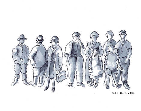
In their turn the Normans, after their invasion of 1066, were equally interested in investigating the bounds of their newly-acquired territory. Unlike the Saxons, who only listed land boundaries, the Normans also made an inventory of all the goods and chattels the land contained. Consequently, by 1087 a register listing all this information, known as the Domesday Book, was produced. Fovant has a brief mention in this book, but as far as the ordinary people were concerned the entry merely notes that Fovant has ‘ seven freed men, eight villagers and seven bordars ’.
The majority of that entry concerned the assessment of the land, rather than the people themselves. There is more discussion on this topic in the Services / Government page.