Footpath
From the southern end of path No. 2 leading east for about 137 m, then north and north-east for about 24.6 m and east for about 39.3 m to the Fifield Bavant – Dinton road, C.64, and continuing south-east through the allotments to its junction with path No. 1 at the south-east corner of Fir Hill Plantation, then south-east skirting the field edge, across path No. 6 to the Salisbury – Shaftesbury Trunk Road, A.30, at the Pembroke Arms Hotel. Approximate length: 1370 metres. Width: 0.91 metres. Part subject to ploughing.
West to East
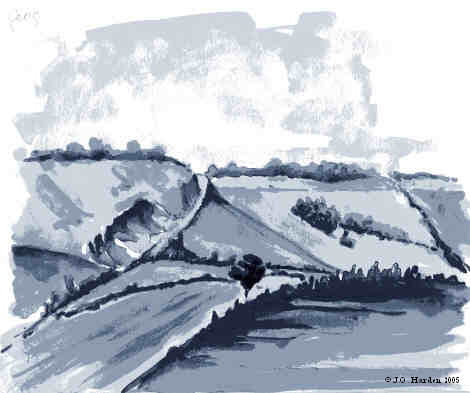
Start where the footbridge over the stream near Church Lane leaves Path 2 and go east to near a double step stile (998294) beside a locked gate. Although the official path crosses an open field on a faint footpath towards a 3-bar stile at the rear of a group of houses, there is now an unofficial, but extremely convenient, diversion alongside the hedgerow to the north [1]. This path emerges on the Dinton road. (TAKE CARE HERE).
On the opposite side of the road a metal finger post (000294) indicates a Public Footpath to Compton Chamberlayne showing a distance of 1½ mile. Go through the kissing gate [2] leading to an open field where the path goes diagonally to the southern corner of Fir Hill Plantation and turns left along the boundary of the Plantation until another kissing gate is reached (002293). This gate was erected by the South Wilts Ramblers [3].
Now you should turn right in a south-easterly direction keeping a wire fence on your right-hand side and a cultivated field on your left.
At the junction with Path 5 there is a kissing gate (004291) where the way ahead is confirmed by one of a set of Public Footpath discs pointing through a slightly open farm gate [4]. Now carry on with an open field on the left and a wire fence, with vegetation, on the right. The fence on the right is interrupted occasionally with private stiles and gates, but a gap (005290) indicates a steep Path 6 leading down to High Street.
Our path passes a large paddock through kissing gates with farm buildings on the left and then to a gate near the A30 (007286). A flight of steps (improved by South Wilts Ramblers) leads to the road where there is a metal finger post indicating a Public Footpath to Compton Chamberlayne at a distance of 1¾ mile [5]


East to West
From the start of the path [5], near the Pembroke Arms (007286), climb the steps and through the gate and then follow a rather indistinct path up through the nettles, keeping the farm buildings on your right.
Go through kissing gates across a paddock and follow the fence on the left that is interrupted occasionally with private stiles and gates. A gap (005290) indicates a steep Path 6 leading down to High Street.
At the junction with Path 5 there is a slightly open farm gate (004291) where the way ahead is confirmed by one of the Public Footpath arrows pointing beyond the gate [4]. Now carry on with an open field on the right and a wire fence, with vegetation, on the left.
When you come to Fir Hill Plantation, turn left through a gate (002293) [3] and keep the boundary of the Plantation on your right. At the corner of the Plantation cross the field diagonally to the right, aiming for the kissing gate (and the speed limit and footpath sign) on the Dinton road [2] (000294).
Cross the road bearing slightly right (TAKE CARE HERE) and then follow the unofficial path which has been diverted around the houses. At the end of the diversion (998294), you join Path 2 on the footbridge across the steam.
M.C.L.H.
July 2002