Footpath
From the Fifield Bavant – Dinton road, C.64, near the eastern end of Mary Barter Lane, leading north-east and east along the southern side of Clap Gate Wood to its junction with path No. 3. Approximate length: 137 metres. Width: 3 metres.
West to East
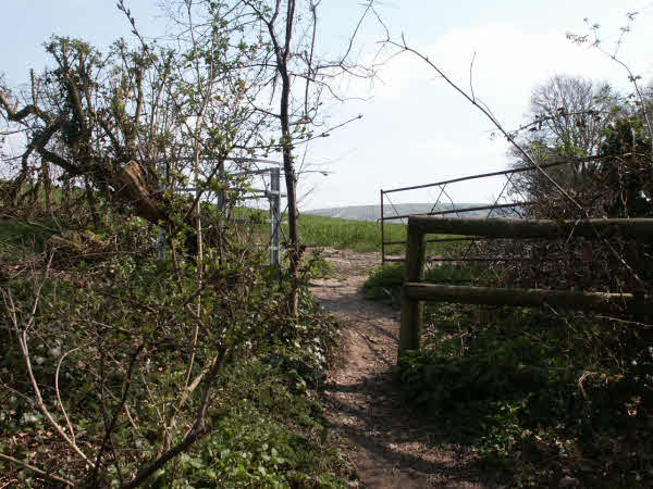
The start of the path, on Dinton Road [1], is marked by a metal finger post indicating a Public Footpath (002291). The Definitive Statement is slightly misleading in that the path starts near the eastern end of Mill Lane, rather than Mary Barter Lane. It quite clearly passes between two private houses, their gardens and outbuildings, before bearing right with open woodland on the left. The track of the old Camp railway is obvious where the path crosses it [2]. As the path climbs [3], it narrows before coming to an old stile (003291) [4]. A Public Footpath disc on the other side of the stile marks the way back down to Dinton Road and other discs point left through a kissing gate and right through a farm gate as the path joins Path 3


East to West
When leaving Path 3 [4] , go down through an old stile (003291) marked with Public Footpath discs. As the path widens it crosses the track of the old Camp railway [2], before going between two private houses, their gardens and outbuildings. The end of the path, on Dinton Road [1], is marked by a metal finger post indicating a Public Footpath (002291). The Definitive Statement is slightly misleading in that the path ends near the eastern end of Mill Lane, rather than Mary Barter Lane.
M.C.L.H.
December 200