Footpath
From road U/C 12004, opposite the Manor House, leading north-east and then north to the Teffont Parish boundary, south of Teffont Mill. Approximate length: 1371 metres. Width: 0.91 metres. Part subject to ploughing.
South to North
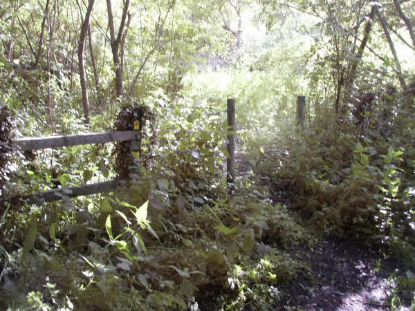
The path starts off in Church Lane opposite the Manor House, where there is a metal finger post indicating a Public Footpath to Teffont at 1¾ mile distance (997294). A wide path in the direction of the finger post crosses a stream on a footbridge immediately after which there is a fence and a gap on the left. A yellow arrow points into a wood [1] where the path is on a raised causeway (built by Wiltshire Council) over a waterlogged area. Towards the end of the wood, bear right up a slope to an old stile (998294), which may be bypassed. Wiltshire Council waymarks pointing left (north-east) along the fence show the way to go.
Keeping to the wire fence along the side of an open field, the path is fairly obvious. You should ignore two wide gaps into fields, the first of which is the route of the old Camp railway . Traces of this railway can be found all along this path and you can find out more about it by clicking on the link.
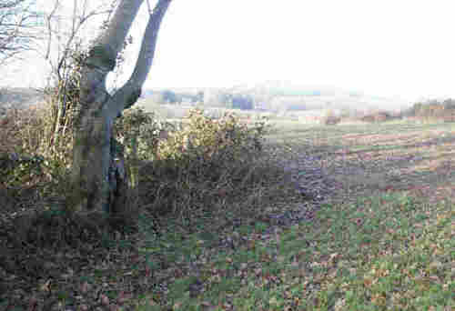
At the end of the field you will enter a small wood across a stile (000297). There are Public Footpath discs indicating the route fixed to a tree by the stile. A very short well-trodden path goes through the wood to a gap from where you can see the route straight across a field [2] to a stile with three crossbars. The field is very often cultivated. If the crops are short, the stile is easily visible and if the crops are long, there should be a cleared path.
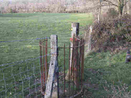
Cross the stile, a wooded boundary and a track before passing through an iron gate (001300) into an open field. Bear slightly left and look for another iron gate beyond the old railway cutting [3]. Turn right after the gate and bear slightly left of the fence on your right across an open field to bring yet another iron gate into view. This gate (001302) is in a wire fence along a thin line of trees.
Passing through the gate, the route of the old Camp railway and a wire fence can be seen on the right [4]. Head towards a slight bend in that fence, aiming slightly to the right of a red-roofed house in the distance. Shortly, the farm buildings of Teffont Mill will become visible and the path will converge on to the old railway embankment, which you should keep on the right until near to the end of this section (001304) where there should be a cleared path to the left. Then you should aim to the right of the distant farm buildings until a stile appears to the left of scrub.
The stile is waymarked and the path leads down to a good footbridge across a stream [5]. Beyond the footbridge there are two other stiles crossing open ground with the River Nadder to the right. The path is quite clear to the Parish boundary, where there is another stile (000306) with WCC waymarks. This is the start of a Teffont path around Mill Farm.


North to South
Coming from Teffont Mill (000306) you will cross three stiles with the River Nadder on your left, until you come to a small footbridge [5]. Climb the bank straight ahead from this bridge and cross another stile.
You should then cross a cultivated field, bearing slightly right to the old railway embankment (001304) and having reached it, turn right keeping the embankment on your left [4].
As you get near the field boundary, look for an iron gate (001302) and once through it, bear slightly left to cross a field towards another iron gate [3] (001300).
Here, you will once again see the route of the old Camp railway, this time in a cutting which you must cross before turning right towards yet another iron gate. Cross the track and climb a stile. You must now head very slightly left towards the wood on the horizon. The field that you are now in is very often cultivated. If the crops are short, look for a stile at the entrance to the wood. If the crops are long, there should be a cleared path.
Cross into and out of the small wood (001297) and follow the side of the cultivated field, keeping the fence to your right. Near the corner of the field (998294) is a stile, which may be bypassed to cross down into a spinney. The path through the spinney should be obvious across the causeway built by Wiltshire Council to prevent the path being waterlogged when the river level is high.
A gap in a fence leads out of the spinney [1] where you may turn right to cross the footbridge over the river and on to the end of the path, on Church Lane (997294). Alternatively, you can turn left, whereupon you are on Path 3 .
M.C.L.H.
June 2004